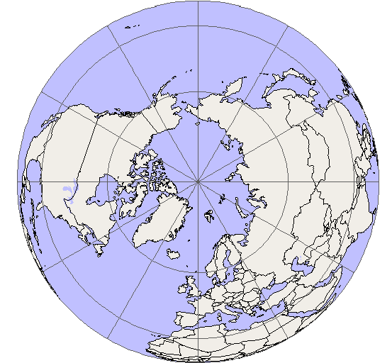
I'm still sticking to my Torus World (Donut World) and Polar World (North Pole World) concepts. But, I've thought about the round map...

In order to accommodate the stretched aspect of a wildly-configured projection map (like a polar map), the outer edges (especially sea lanes) would need to allow for faster travel (to better-reflect realism). Now, that idea hasn't been implemented and I suspect the folks at Bytro might not have been able to conceive of this solution:
I think the idea of "speed lanes" could fix this. It may be a necessary additional programming aspect of the game that would require a core programming update, but the speed of units as they move along a path could have an additional element added that would query the path that they are on (when in motion). If the path set as "normal", the speed is unaffected by the path (though it IS affected by the province (terrain, ownership) if on land). But, if the path is "speed_adjusted", then the unit's speed would be adjusted (by percentage) up or down.
Perhaps there could be different levels of speed adjustments (i.e., adjustment multiplier "ticks" set at 0.5, 0.9, 1.3, 1.7, 2.1, 2.5 respectively) which would then be used on the current speed of the unit in transit. The varying ticks would prevent shortcuts from being sought by players trying to hug the innermost speed lanes to sneak around the outermost regular speed lanes. To keep from over-complicating things, perhaps air units (in flight) would not be affected.
************************************************************************************************************************************************
In addition to the above polar and torus maps, this upper-northern projection map (posted previously, also) might be able to be gotten away with not having speed lanes, but the edges might need to be trimmed to have less ocean. This is my proposed Eurocentric Arctic World Map.

************************************************************************************************************************************************
The whole point of adding these polar view (and torus) maps is to change the ocean dynamics for travel between continents. Let's have an arctic war. Let's have a Torus war (north and south map edges connect while Antarctica doesn't exist).
 It seemed like such a waste to destroy an entire battle station just to eliminate one man. But Charlie knew that it was the only way to ensure the absolute and total destruction of Quasi-duck, once and for all.